Out of Hopeful Green Stuff Woven
Published April 2022
By Gordon Grice | 18 min read
On the highway to Rita Blanca National Grassland one wind-torn afternoon, I found a trio of pronghorn pacing me. I was going sixty, which means they were too. Pastures of yucca and buffalo grass unrolled around us. The three bounded to within ten feet of the road—maybe less. I could see the chocolatey fur of their snouts, the rough texture of their horns. They seemed ready to spring in front of me. Ten feet looked like an easy leap for them. I wouldn’t give them the chance. I sped up. So did they.
I eased off the gas. Maybe they would cross in front of me. Clouds were rolling over in the wind, making shadows flicker over the whole scene. It was a surreal moment. The pronghorn paralleled me for a minute more, and then their white rumps flashed as they pulled ahead. Almost instantly, they curved away, as if they’d proved their point. On this rolling ground, they were out of sight in seconds. A shower began, though the road ahead remained in sunshine.
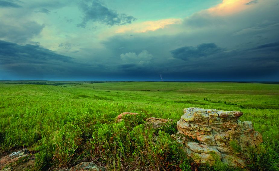
Spring storms roll across the Joseph H. Williams Tallgrass Prairie Preserve in Osage County near Pawhuska. Photo by Mike Fuhr
This is the sort of thing that happens in Oklahoma’s protected grasslands. You might not see pronghorn, but you’ll see something. Oklahoma’s climate is widely varied from one end to the other, and that means the state is home to several different biomes. The Rita Blanca is a protected shortgrass prairie at the extreme western end of the state, taking in part of Cimarron County and extending into the Texas Panhandle. Those short grasses include blue grama and buffalo grass, species that can survive a semi-arid climate with wildly varying temperatures. (Historically, Cimarron County has ranged from 24 below to 109 above.) Plants have to manage their water well to thrive here. That requirement can favor plants with odd shapes—like the yucca, which looks like an explosion of javelins, and the Panhandle prickly pear, which looks like an untidy pile of oven mitts covered with needles. In wet summers, the shortgrass prairie is likely to break out in wildflowers it hasn’t seen for years. Their seeds have lain dormant, waiting out the dry spell.
Of course, game animals like pronghorn—not technically antelope, but nobody will mind if you call them that—are the main attraction for many. Hunters find dove and rabbit in abundance and sometimes mule deer, coyote, blue quail, and pheasant. For birdwatchers, the area is rich—dickcissels and rough-legged hawks, northern bobwhites and Chihuahuan ravens. One of my favorite memories of the Rita Blanca is seeing some distressed person in the distance struggling to take off his jacket. With the help of binoculars, I found out he was actually a gangly sandhill crane, fluffing himself up in the wind. If you look down, you may spot a Texas horned lizard lapping up ants.
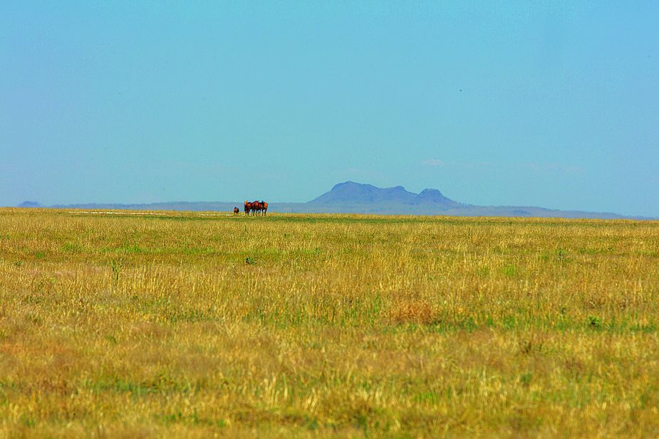
Located near the town of Felt, the Rita Blanca National Grassland spans 93,000 acres of the Texas and Oklahoma Panhandles. Photo by Brent Fuchs
The shortgrass prairie is one of the least-threatened ecological zones in the world, because it’s hard to farm. People found that out the hard way in the 1930s. The space we now call the Rita Blanca was pretty much the epicenter of the Dust Bowl. Things began to go wrong when gasoline-powered tractors came onto the market. Farmers used them to plow deep, tearing apart the roots of the native short grasses. They didn’t know that these root networks preserved water and held the soil in place against high plains wind.
Without that protection, the soil ripped loose, storms sometimes carrying it several states away. On April 14, 1935—the notorious Black Sunday—residents of Cimarron County witnessed what looked like a solid black mass rolling across the prairie. There was no time to get out of its way. Next morning, the air remained dark as night and painful to breathe.
My grandfather, who lived next door in Texas County, told me he couldn’t see to take care of the livestock. He had to feel his way along the wagon ruts to the barn with his feet. Scientists estimate three hundred million tons of prairie topsoil flew through the air. And that was only one particularly bad day in a disaster that spanned a decade. Doctors in subsequent years could tell the x-rays of lifelong residents by the specks in their lungs.
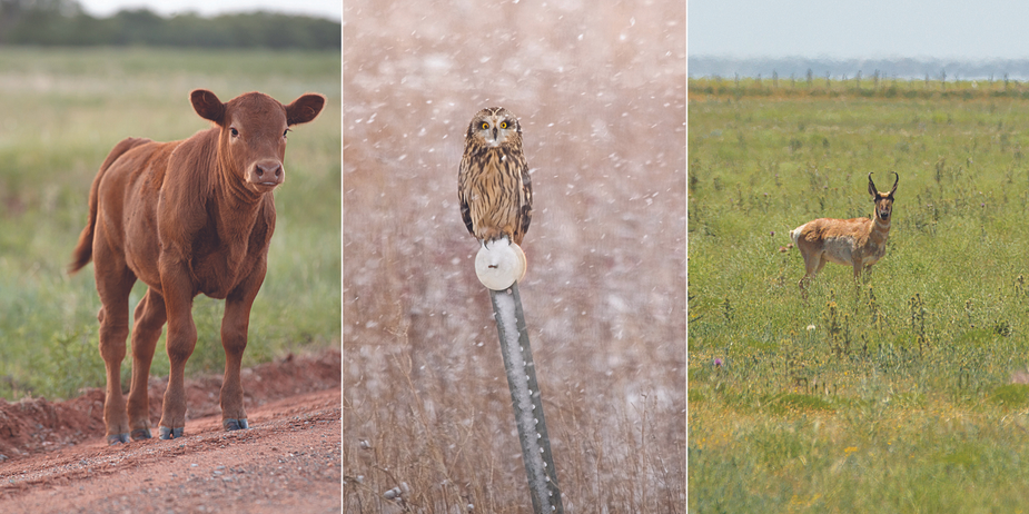
From the everyday to the more uncommon, many species of animals—including cows, owls, and pronghorn—make their homes on protected Oklahoma grasslands. Photos, from left, by Brent Fuchs, Mike Fuhr, Brent Fuchs
Until the Dust Bowl, most people were unaware of how deeply modern farm practices can affect nature. In response to the disaster, the federal Soil Conservation Service bought up drought-blasted tracts of land to restore them. They were designated as protected grasslands and put under the care of the U.S. Forest Service by 1960. Some of them—a patchwork mix of public and private lands rather than a continuous tract—are now the Rita Blanca.
Protecting soil is only one way grass keeps us safe. Scientists have come to understand that grasslands also are a powerful resource for regulating carbon. Carbon dioxide in the atmosphere traps the sun’s heat and raises the planet’s temperature. Too much of it makes the planet increasingly inhospitable for most kinds of life—humanity included. Plants help. They literally inhale carbon dioxide and convert it into tissue and food. We’re used to hearing that forests can help regulate carbon dioxide. We rarely hear about the similar role of grasslands. Grasses tend to spend a lot of the carbon they draw from the air on root building. That means the carbon is safely locked up underground rather than in the air.
In Osage County, the Joseph H. Williams Tallgrass Prairie Preserve showcases a moister ecology. Its dominant grasses include big bluestem, which can grow ten feet tall and reach just as deep with its roots. Bluestem is also called turkeyfoot because of the shape of its flowers. Visitors will see switchgrass, which usually stands a little shorter than big bluestem; its flowered tops look like wild hair. And Indiangrass, our official state grass—yes, we do have such a thing—is common here. It grows in thick bunches topped with yellow-brown flowers that result in soft plumes of seed. The tallgrass prairie defined by these plants used to cover parts of fourteen states. Now, it’s fragmented and threatened. The biggest remaining patch of it—more than forty thousand acres—is the Williams Preserve. Historically, the area was home to people of the Kaw, Wichita, Osage, and other tribes. For decades, it was part of the sprawling Chapman-Barnard Ranch. It became a protected area when the Nature Conservancy purchased it in 1989.
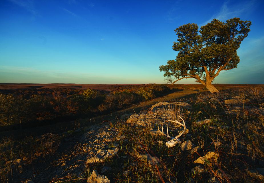
Prairies exist where the land is too wet to be desert and too dry to be forested. Most of the foliage at the Tallgrass Prairie Preserve is made up of 40 to 60 species of grasses. Photo by Mike Fuhr
It’s not just the grass itself that differs here but the entire ecosystem it supports. The Tallgrass teems with butterflies. A particularly poignant example is the regal fritillary, a species elaborately dressed in orange, black, and white, most visible between June and September, scudding low over grass and ground. The species has gone extinct in parts of its historic range and is considered vulnerable. Habitat loss is the reason. We’ve lost 99 percent of the country’s tallgrass prairies, mostly to human activities like agriculture, urban development, road construction, and mining. Places like the Williams Preserve hold the best hope of saving species like this. The preserve’s management takes care to keep the prairie in its natural state. They even conduct controlled burns to mimic the effects of lightning on wild prairies. The fires allow the wildflowers to proliferate, producing even more nectar. The nectar helps to support a more robust crop of regal fritillaries.
More than two hundred bird species live in the Williams Preserve, including the greater prairie chicken. In the spring, the male prairie chickens dance, inflating the orange pouches on their throats and making the sort of sounds you’d expect from a nervous person with a kazoo. It’s all about impressing the females.
This is a good place to see the state’s official bird, the scissor-tailed flycatcher—gray fluff above, butterscotch beneath, and always ready to flash its red armpits in flight. I’ve seen the males flex their long scissors forward a second before stepping into the air as if to lend momentum. On summer days, you may see them sitting on barbed-wire fences, possibly with the crinkled remnants of dragonfly wings jutting from their beaks.
Beaver and armadillo, bobcat and badger abound. The animals you’re most likely to notice when you tour the Tallgrass, however, are the bison. One of the largest remaining herds, more than two thousand strong, roams here. The preserve, which operates under the auspices of the Nature Conservancy, considers the bison key to good tallgrass prairie management. Their hooves break up and aerate the soil, helping the plants grow. They transport seeds within their digestive systems. They even transport seeds that snag or blow onto their shaggy hides. Where bison live, biodiversity increases. Ironically, at the Williams Preserve, they graze among working oil derricks established long before the Nature Conservancy stepped in. The land beneath remains a rich deposit.
Most of Oklahoma is neither shortgrass nor tall but a transitional zone simply called mixed-grass prairie. The ideal place to see this sort of land in its wild state is the Black Kettle National Grassland near Cheyenne. This is classic Oklahoma, with its red dirt and wind-rippled grass. Its shale hills look bitten, a sort of erosion that happens in a land where wild storms punctuate drier weather. A few mesquite trees mingle with sagebrush on those hills. Along the rivers and creeks, elms, cottonwoods, and hackberries thrive. The animal life here includes raccoon and bobcat, quail and dove, deer and rabbit. The Rio Grande wild turkey is a special draw for hunters.
The Black Kettle is named for a Cheyenne leader who died here. It’s a tragic part of history. The story begins one November morning in 1868, when Chief Black Kettle stepped from his lodge at first light into a landscape knee-deep in snow. Before the cavalry band sounded the charge and the shooting started, his eyes may have swept over the icy Washita River where it wound among the naked hackberry trees. Maybe he even had time to glance at the hills beyond, where mounted men with rifles waited.
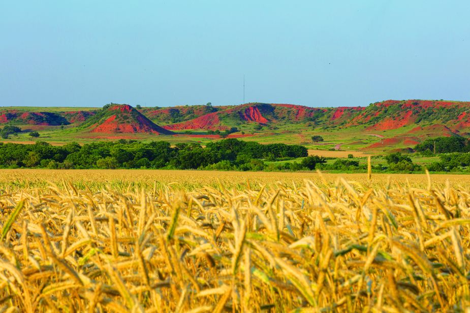
Though they stretch into Texas, the majority of the Black Kettle National Grassland’s 31,300 acres are located near Cheyenne and include the Washita Battlefield National Historic Site. Photo by Brent Fuchs
The gunfire began. This wasn’t Black Kettle’s first massacre. For four years, his wife had carried the wounds of shrapnel and bullets from the Sand Creek Massacre in Colorado. They’d both lived through that one; they wouldn’t live through this. The couple fled on foot. They were trying to cross the frigid Washita when soldiers gunned them down.
In command of this expedition was Lieutenant Colonel George Armstrong Custer. His troops killed at least sixty people that day, including members of the Southern Cheyenne group Black Kettle led and some Arapaho allies. The cavalry lost twenty-two. It was meant as a punitive strike because of Indian raids on settlers in western Kansas and elsewhere throughout the region. It’s doubtful that Black Kettle, who had pursued a policy of peace with whites, had anything to do with planning those raids, though he may have sheltered the raiders afterward. Two women escaped the carnage by hiding in tall red grass protruding through the snow. A soldier spotted them, made eye contact, and decided to save their lives by not mentioning their presence.
The snow reddened with the blood of people and especially of horses. Custer’s men slaughtered 650 Cheyenne horses. Without horses, the Cheyenne could neither raid nor hunt bison. Decades later, in the 1930s, the bones of horses still lay thick enough on the ground to be shoveled up for fertilizer.
It was only one episode in the wars against Indigenous people on the Great Plains. Custer was less than eight years from his fatal encounter with Cheyenne, Arapaho, and Sioux forces at Little Bighorn. The Southern Cheyenne, meanwhile, had been crippled by the events on the Washita and were forced onto a reservation. At the Washita Battlefield National Historic Site near Cheyenne, which shares headquarters with the Grassland, visitors can walk the battlefield, downloading information to their phones from markers along the trail. The area where Chief Black Kettle’s camp once stood is crowded with high grasses, their roots gripping the soil, tying Earth to Heaven.
Rita Blanca National Grassland
The Rita Blanca National Grassland is located in southwestern Cimarron County near Felt and is managed by the United States Forest Service. For more information, visit fs.usda.gov/detail/cibola and click the Kiowa/Rita Bianca National Grasslands link at left or call (575) 374-9652.
